First for Western region, tool recommends species based on farmer goals, local conditions
For the first time, farmers in California and throughout the West have a decision-support tool that recommends cover-crop species based on growers’ unique situations and goals.
“This tool is the first of its kind – publicly available, free to use, and validated by experts in the Western region, about Western cropping systems,” said Sarah Light, University of California Cooperative Extension agronomy farm advisor for Sutter, Yuba and Colusa counties.
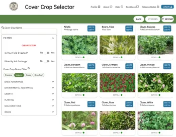
Light, president of the Western Cover Crops Council that spearheaded the project, is the principal investigator on the tool, which can be found at: https://westerncovercrops.org/decision-tools/.
With this addition of the Western region (Alaska, Arizona, California, Colorado, Hawaii, Idaho, Montana, Nevada, New Mexico, Oregon, Utah, Washington and Wyoming), the resource now includes all 50 states.
Light credited a broad coalition of partners for their input and guidance in completing the two-year project – farmers, academics, technical assistance providers, seed company representatives and other agency and industry personnel.
“This project was a collaboration between the Western Cover Crops Council, Precision Sustainable Agriculture, and the U.S. Department of Agriculture’s Natural Resources Conservation Service,” she said. “This partnership enabled the project’s success, as the WCCC verified the data, while PSA provided technical expertise around data stewardship and website development.”
Tool offers recommendations, database of suitable cover-crop species
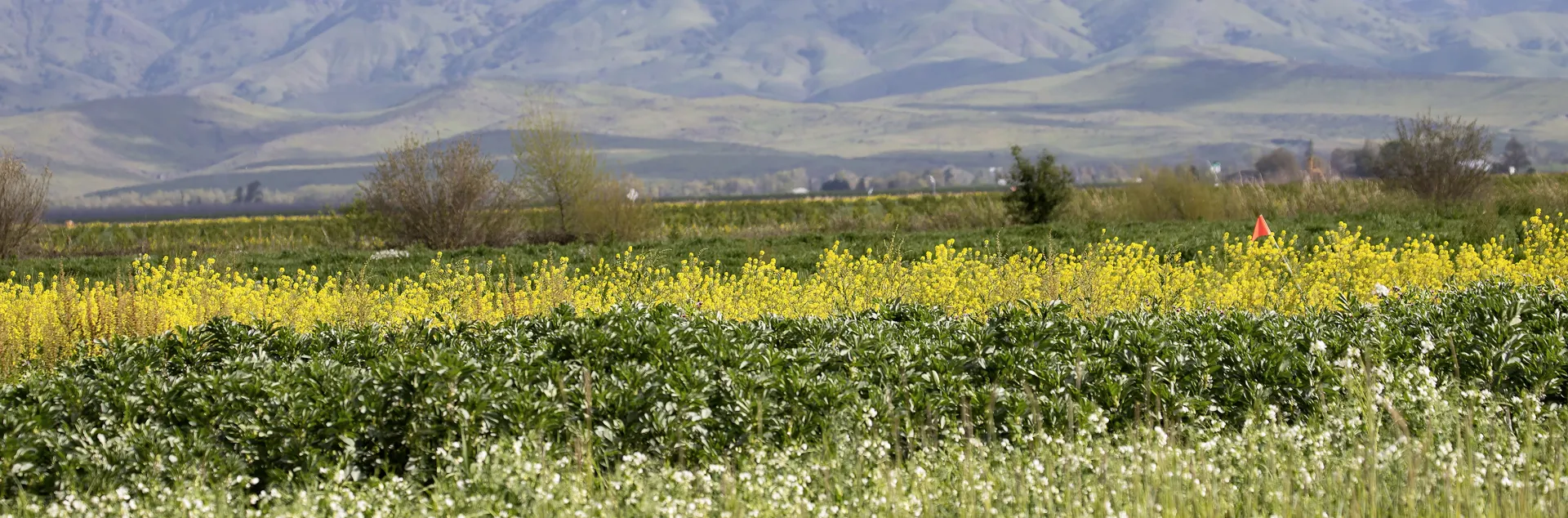
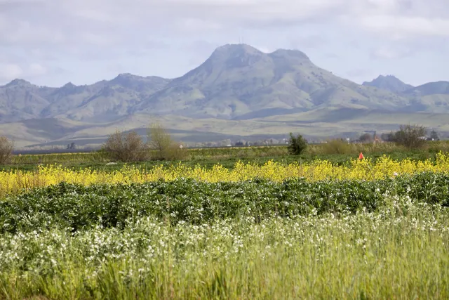
Cover crops can provide a wide range of benefits for growers and the environment, such as improving soil health, suppressing weeds, reducing erosion and sheltering pollinators. But choosing specific species from an enormous palette can be daunting.

“When farmers start using cover crops, they always ask what cover crops to start with,” said Nick Andrews, Oregon State University organic vegetable Extension specialist and Western Cover Crops Council secretary. “That’s always a complex decision to make, because it depends on their reasons for cover cropping, their soil and climate, when they can grow cover crops during the year, and other factors.”
After pulling in auto-populated soil and climatic data at a given location, the new online tool allows farmers to select up to three goals for their cover crops and adjust settings tailored to their own operation and setting. The tool then generates a custom list of recommended cover crops, which are sortable by goal priorities and filterable by a variety of characteristics.
Alternatively, growers can simply browse the tool’s “one-stop shop” of common cover-crop species, hand-picked by experts for their state.
“Not only does this tool help with species selection, but it’s also now the most comprehensive database of cover-crop species for our region,” Light said. “It has comprehensive information – about the basic agronomics, environmental tolerances, growth habits, planting, soil conditions, termination and more – for each species.”
Novel methods helped produce first-ever cover crop selection tool
Previously, deciding on a cover crop species was even more challenging because growers had to cobble together information from local Cooperative Extension farm advisors, scattered databases and tools borrowed from other regions across the U.S. This was less than ideal, of course, due to unique conditions in the West – such as the lack of a hard frost in many areas.
“We had to create a more nuanced tool for the West because of these complex growing systems and our long growing season,” Light said.
The Western Cover Crops Council was the last of its sister regional councils to form, and the last to build its cover-crop selection tool.
“Our region is the largest in the country, and we also have a wide diversity of climates and cropping systems – everything from Alaska to the Pacific Northwest, the Rocky Mountains, the Southwest, and the Pacific Islands,” Andrews said. “We worked with developers and testers who have built similar tools in the Midwest, Northeast and South and their expertise made this work possible.”
The team’s approach to validating the data in the tool was also notable. Light said that attempting to conduct separate research trials for dozens of species in 11 climatic zones across 13 states would be “an impossible amount of work.”
Instead, the team gathered experts to rank the capacity of different species in achieving specific goals in specific locales. For example, the tool ranks species on nitrogen-fixing potential – but does not estimate the amount of nitrogen fixed by each species. Users can thus see which cover-crop species will best accomplish their goals in their own region and cropping system.
“This method of data verification allowed us to capture the knowledge of experts throughout the West to develop a comprehensive cover crop dataset for our region,” Light said.